Satelliten
Satellites are used for almost all modern achievements, from communication or navigation systems to environmental monitoring and military purposes. By now there are approximately 3000 satellites in orbit, about 1000 of those are still operating. The majority of these objects revolve our planet in 200km to 2000km height, with an orbital period of 90 to 130 minutes.
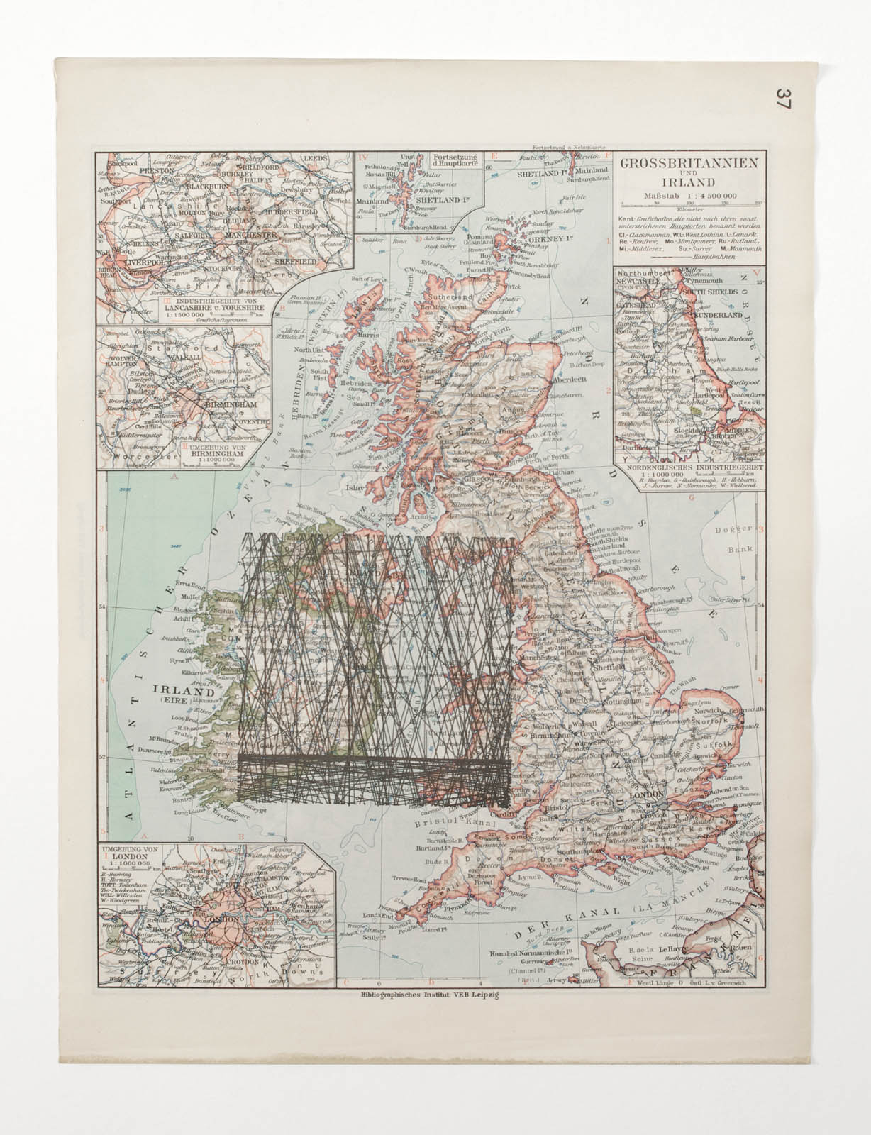
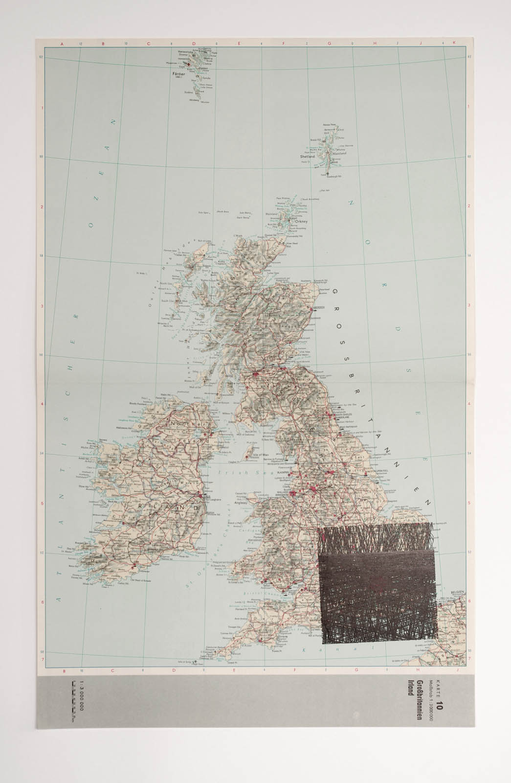
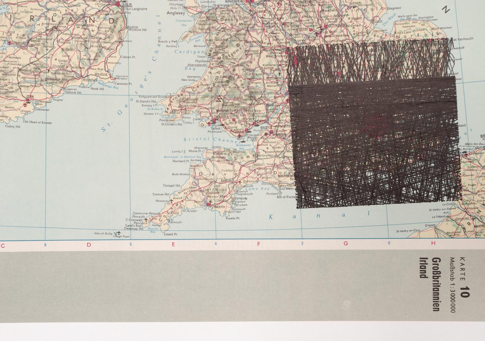
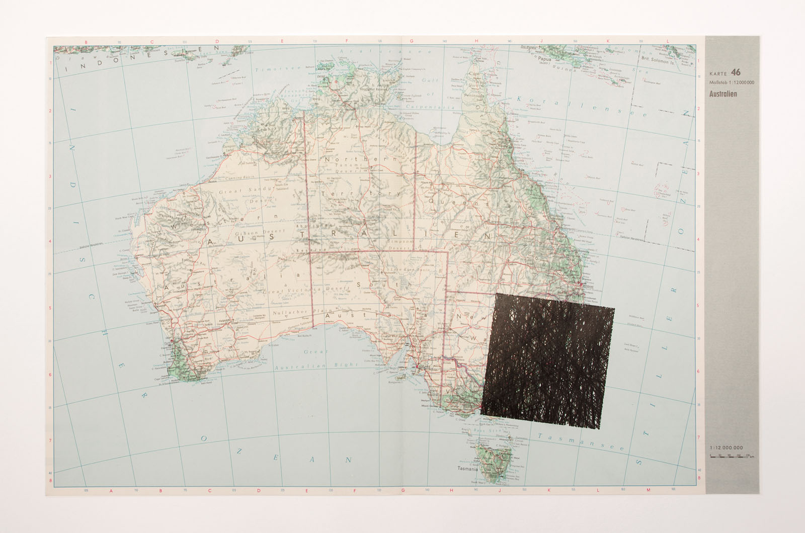
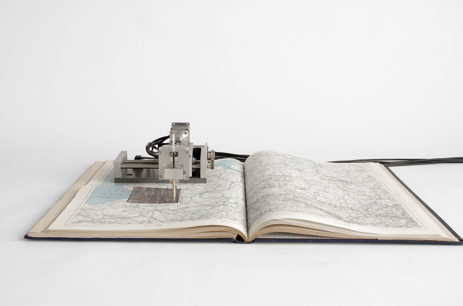
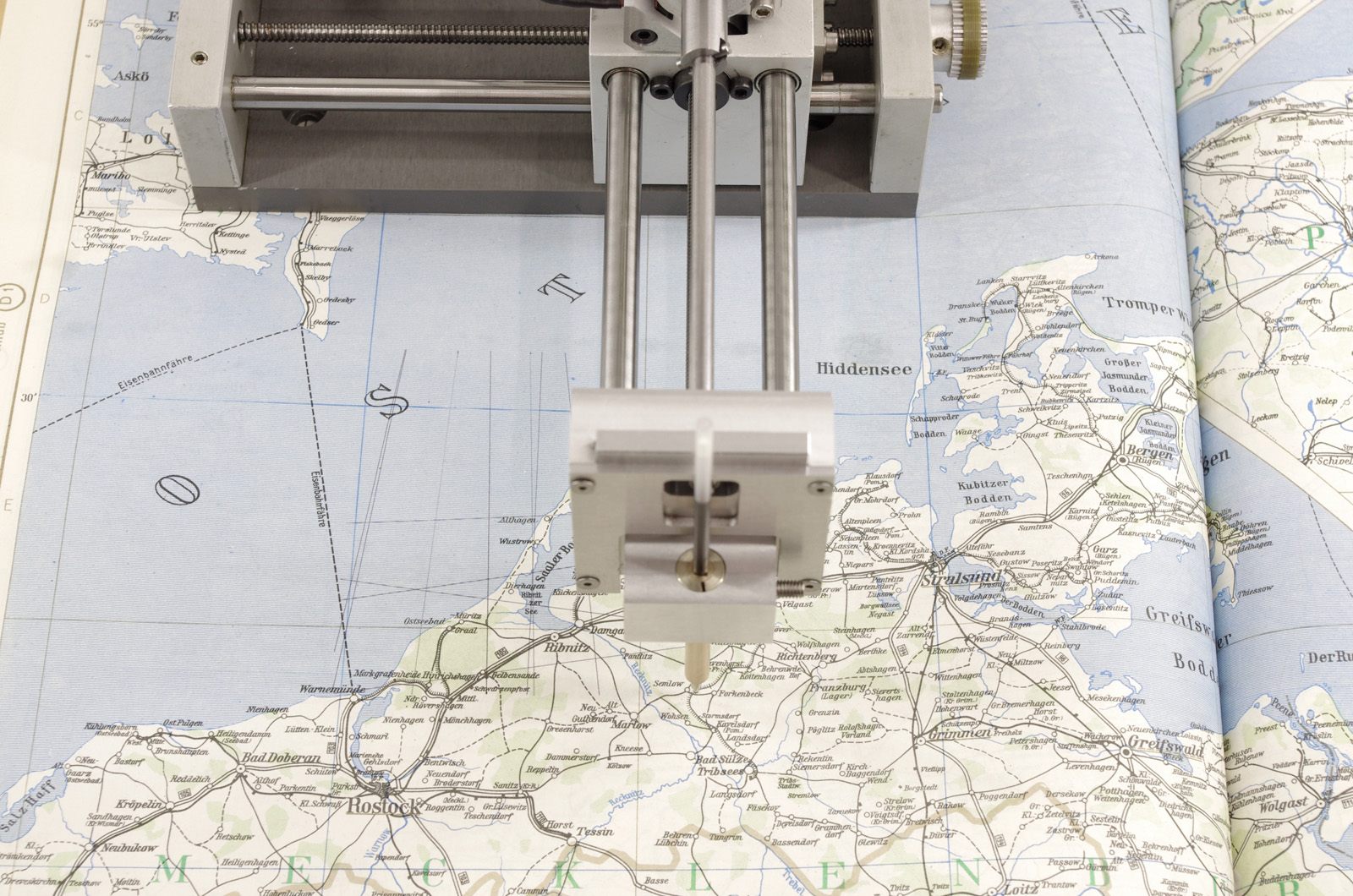
Despite their overall application, we hardly notice their existence. From earth they are visible only in the rare case, that they are in the perfect angle to reflect the sun. All necessary data about the positions and paths of satellites is known though, as it is crucial for determining free spots for new satellites. Accessing this information allows the drawing machine SATELLITEN to keep record of the sheer amount of satellite flyovers in regard to its own location. In a square of approximately 10 cm², the machine traces their lines in real time until the far away object leaves our horizon again.
SATELLITEN uses its own position as starting point and old maps of the area as a base for its drawings. For a long time, maps and atlases used to be one of the only sources for geographical knowledge. Now the paths of the satellites start to form on top of the familiar neighbourhoods, thus setting the normally invisible traffic in relation to our usual habitat. But as time passes the lines of the satellites will obliterate the well-known streets and cities, overwriting not only the information the map originally contained but as well the marks left by the preceding satellites. In the long run only a black square will be left, it is the remains of this rather parasitic machine: a temporal window, showing the seemingly arbitrary but highly structured activities in lower earth orbit.
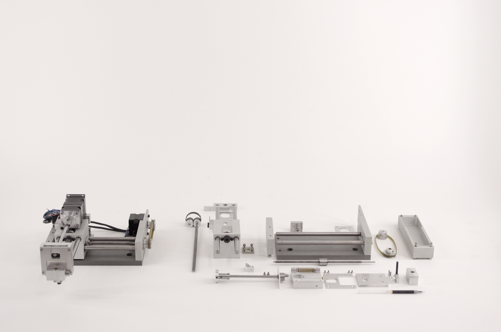
Material: maps / atlas, pen, stepper motors, motor drivers, electronics, sensors, aluminium, Arduino microcontroller, MiniPc
Software: vvvv, c#, grbl
Size: 20 × 20 × 10 cm (without book / map)
Thanks to Woeishi Lean!